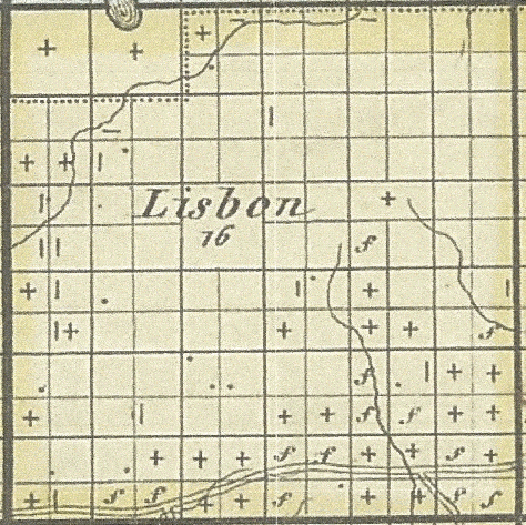
Lisbon Township Property Sold in 1846
Added January 16, 2016 by Michael R. Reilly
Excerpt from:Short Title Map of a part of Wisconsin : showing all the land sold in the Milwaukie land district : May 1846 Full Title Map of a part of Wisconsin : showing all the land sold in the Milwaukie land district : May 1846 / by Jervis & Edgerton. Map Creator Jervis & Edgerton Date Original [1846] Description This 1846 map of southeastern Wisconsin shows the counties of Dodge, Washington (including modern-day Ozaukee County), Jefferson, Waukesha, Milwaukee, Rock, Walworth, and Racine (including modern-day Kenosha County), as well as portions of Green, Dane, and Columbia counties. Lands sold, school sections, university land, and tracts not offered at public sale are indicated.

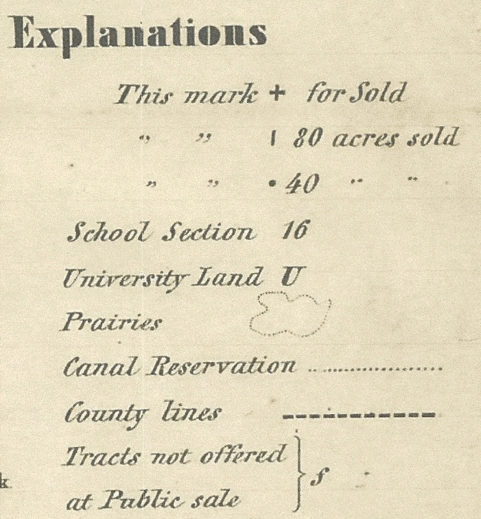
Above: Interesting to note that the sole road is Lisbon Rd. In Milwaukee it was being redone into a “Plank Road” but the creation of Waukesha County stopped the project until 1849. Also, Sections 5 and 6, and all along the northern county line indicate the land is still “canal reserved”; i.e., the land all south of this line still is considered possible for canal development. Generally, the sections marked with a “f”, and not for sale, are prime areas for canal development.
Below: Key to Map Above

Source:http://content.wisconsinhistory.org/cdm/singleitem/collection/maps/id/1071/rec/10
